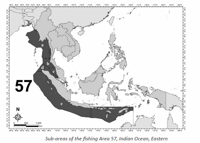
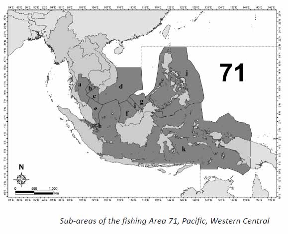
Area 71 (Pacific, Western Central)
Under fishing Area 71, marine fishery statistics such as production, species, fishing gears, fishing vessels, fishing units,
etc., will be collected and reported within the Exclusive Economic Zone (EEZ) of each country. There are 8 Southeast
Asian countries identified under fishing Area 71, namely Brunei Darussalam, Cambodia, Indonesia, Malaysia,
Philippines, Singapore, Thailand and Viet Nam. To facilitate reporting fishery statistics by each country, the fishing
area can be divided into 11 sub-areas, corresponding to the existing EEZ of these countries. The sub-areas under Area
71 are as follows:
|